As a killer flood was devastating his native India, Wright State computer science student Hemant Purohit decided to put the research he was doing into practice.
Heavy rainfall in the Indian state of Uttarakhand had triggered heavy flooding and landslides. More than 1,000 people had lost their lives and many more were missing.
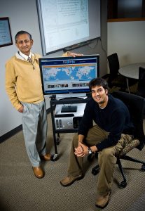
Amit Sheth (left) and Hemant Purohit
Starting with his social computing team’s research platform—Twitris, the techy marriage of Twitter and Tetris—and applying algorithms, his team at Wright State University’s Ohio Center of Excellence on Knowledge-enabled Computing, or Kno.e.sis, monitored the situation by quickly summarizing social media content and users.
But this was inadequate given the lack of social media users participating from the region of crisis. However, a lot of important information was flowing via government websites, forums, and news articles scattered around the web.
So Purohit launched a collaborative editing Google spreadsheet in which digital volunteers around the world were able to fill in information—of an actionable nature with geo-coordinates—by monitoring the news media, reports from government agencies, and non-government organizations, Twitter, Facebook, forums, blogs, and other news sources.
That generated meaningful information from an ocean of data about flooded areas, affected roads, people who had been rescued, people who remained stranded, relief camps, and medical centers.
The Kno.e.sis team hosted the geo-located information from the spreadsheet to provide to its initial partner, the Google Crisis Response team, which made the critical information available on the crisis map for the Uttarakhand floods.
“This initiative was turned into a collaborative effort after receiving support from volunteers of well-known organizations, including StandBy Task Force, Info4Disasters, OpenCrisis, HOT, and CrisisMappersUK. The Humanity Road was also contacted and activated to support. This big effort involved several university students from around the world,” said Purohit.
Purohit was ideally equipped to put research into practice. A graduate researcher at Kno.e.sis, Purohit is part of a National Science Foundation-funded project titled “Social Media Enhanced Organizational Sensemaking in Emergency Response.”
The multidisciplinary project is led by professor Amit Sheth, the principal investigator, LexisNexis Ohio Eminent Scholar of and the director of Kno.e.sis. Co-principal investigators include professors Valerie Shalin and John Flach from the Wright State Department of Psychology and professor Srinivasan Parthasarathy at The Ohio State University.

Crisis map showing roads, medical centers, relief maps, and stranded people in the flood-ravage Indian state of Uttarakhand.
Twitris first mines Twitter for relevant users’ live tweets and analyzes interactions to identify connections, engaging with important players in the social media community. They often consist of professionals working in academia, media, humanitarian work, politics, journalism, and medicine.
Twitris then allows users to look at communication patterns among these “influencers,” helping a potential humanitarian-aid workers’ media team, for example, to speed up digital response by engaging with targeted members of the network. It also finds key phrases in trending stories to quickly summarize the situation. Finally, it provides background information from sources like Wikipedia and news and blog sites to provide relevant context.
“These sets of information presented together give you a good picture,” Purohit said. “Twitris’ current research will be in providing more critical answers during a crisis such as: What if there is a resource center that has been set up 10 blocks away from a disaster victim who needs food and fresh water? How would the two connect? What if a humanitarian-aid team lands in Uttarakhand and needs to better understand the region to help those on the ground? How can we generate recommendations for assisting decision making? How can we evaluate the effective use of such tools?”
In many situations, software like Twitris cannot give a complete picture because not all information can be processed by computers, and the software cannot replace knowledge
from humans who are on the ground and familiar with the local situation.
“We need to understand that many times human computation power cannot be replaced by machine-processable information,” Purohit said. “The role of digital volunteers in such scenarios becomes critical to extract information that will help heighten situational awareness to better coordinate relief efforts.”
Purohit was able to utilize the power of the CrisisMappers network from the experiences of his mentor Dr. Patrick Meier, an international expert in humanitarian response and resilience from the Qatar Computer Research Institute, where Purohit had just completed an internship. The result was the creation of a significant and actively maintained computer-processable knowledge base.
“The outcome was an impressive application of training, research, and international collaboration, made possible in part by the National Science Foundation,” said Sheth. “The research goal is to improve coordination during crises and improve efficiency of crisis response.”
 High school students explore artificial intelligence at Wright State summer camp
  Wright State University and Premier Health Nursing Academy expands affordable pathway to nursing careers amid growing demand
  Wright State’s Boonshoft School of Medicine welcomes new class of future physicians with Convocation and White Coat Ceremony
  Wright State’s Raider Immersion Program connects students to paid defense and industry learning opportunities
  Wright State University Foundation funds 11 projects to enhance student success